Good Sunday bloggers,
May is ending with some locations seeing too much rain and others needing rain. We talked about this yesterday how rainfall amounts for May 2020 ranged from over 7" to under 4" just in Kansas City. This disparity was caused by the flooding rain event on Thursday. KCI received 0.27" while locations around Lee's Summit received 6"-9" of rain.
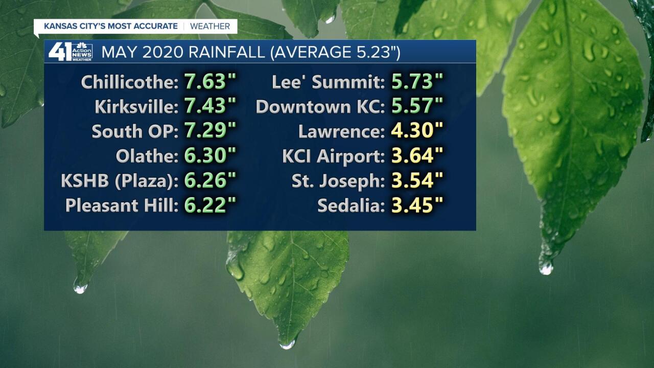
Since KCI is the official reporting station for Kansas City, May will go down as a drier than average month. This makes us right around average rainfall for the first 5 months of 2020.
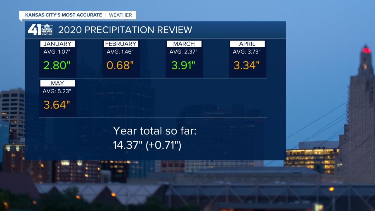
So, what will happen in June? Summer begins on the 20th at 4:44 PM central time. The average rainfall is 5.23" which is the same as May. May and June, on average, are the wettest months of the year. The average high rises from 80 to 87 while the average low rises from 59 to 67. Based on the LRC and the way this pattern has been going, we will most likely see around average rainfall with temperatures mostly near average. Now, we say average rainfall but as we saw on Thursday thunderstorms can create huge disparities over short distances.

Now, let's take a look at the first week of June in more detail.
SUNDAY: There have been some morning rain showers ahead of an approaching warm front. The showers will fall apart by noon leading to a partly cloudy and warmer afternoon. We will make a run at 80 with southeast winds 5-15 mph.

MONDAY: It will be a windy and very warm day with highs 85-90. The wind will be south at 15-25 mph.
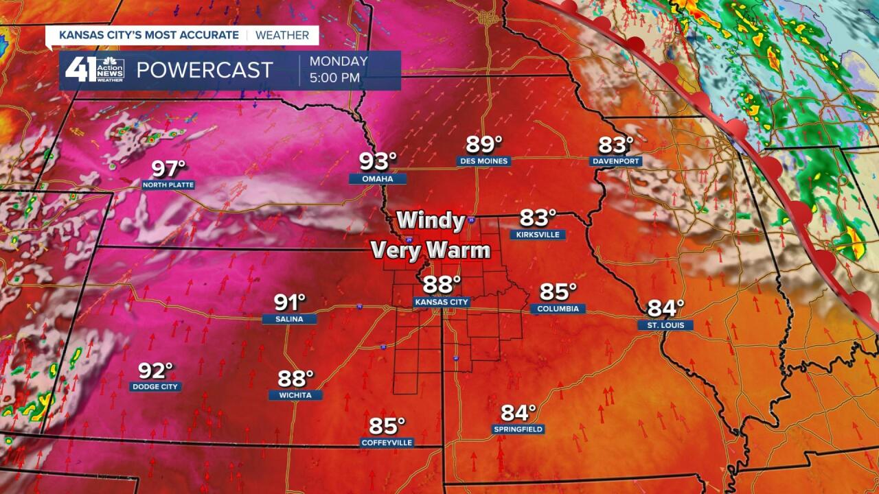
The reason for the drop in rain chances and increase in temperatures is the formation of an upper level high over the southern Plains. An upper level high is also known, during the summer, as the "heat wave creating machine." This is a weak upper level high, but it is enough to keep the rain away Monday and Tuesday and allow our highs to make a run at 90.
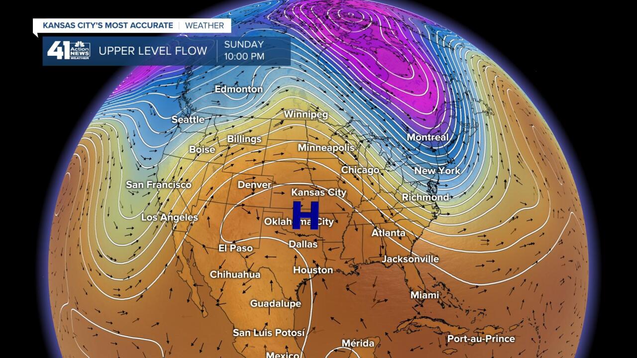
TUESDAY: The upper level high shifts to Arkansas with an extension into Nebraska, including our region. So, we will make a run at 90 on Tuesday with little chance of rain.
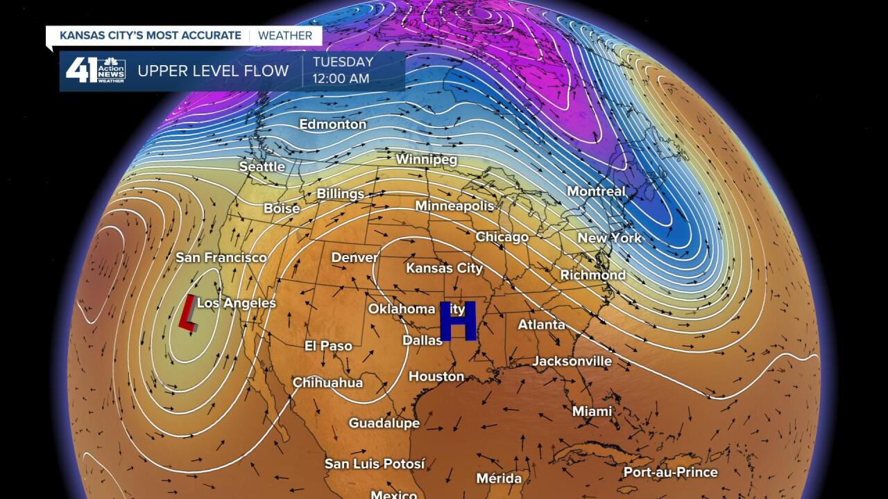
WEDNESDAY-FRIDAY: The upper level high over Arkansas falls apart as a new upper level high forms in west Texas. This now puts us on the periphery of the ridge where the flow is from the west and northwest. During the summer you can get clusters of thunderstorms along the edge of these upper level highs.
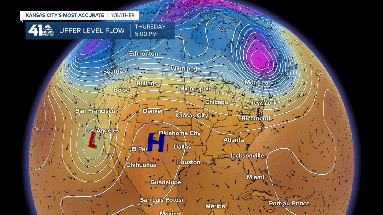
This is what looks like will be happening Wednesday through Friday. Usually what happens in a pattern like this you will see thunderstorms form in the high plains during the afternoon. They congeal into clusters of rain and thunderstorms, known as an MCS (Mesoscale Convective System) as they move east and/or southeast across the Plains and Midwest. They usually arrive in our area during the night and early morning, exiting by afternoon. The severe threats are low, but you can get damaging winds at times along with very heavy rain and some flash flooding.
We will see how this evolves as we get closer to it. Between now and then we are looking at a big warm up with little to no rain.

Have a great week and stay healthy.
"may" - Google News
May 31, 2020 at 08:46PM
https://ift.tt/2ZSlwNH
Weather Blog: May becomes June - KSHB
"may" - Google News
https://ift.tt/3foH8qu
https://ift.tt/2zNW3tO
Bagikan Berita Ini


0 Response to "Weather Blog: May becomes June - KSHB"
Post a Comment